Search
Books+
Searching 1,730 books
Search related to the career Petroleum Geologist
Exploration and Methods Used by Petroleum Geologists to Locate Oil and Gas Reserves
1. Geological Surveys and Mapping: Petroleum geologists conduct extensive geological surveys and mapping to identify areas with favorable geological conditions for oil and gas accumulation. They study surface rock formations, sedimentary basins, and structural features to identify potential reservoirs.
2. Seismic Surveys: Seismic surveys are crucial in locating oil and gas reserves. Geologists use seismic waves generated by explosions or vibrations to create detailed images of subsurface rock formations. By analyzing the reflected waves, they can identify potential hydrocarbon traps and reservoirs.
3. Gravity and Magnetic Surveys: Gravity and magnetic surveys help geologists identify subsurface structures that may contain oil and gas. Variations in gravity and magnetic fields can indicate the presence of sedimentary basins, faults, and other geological features associated with hydrocarbon accumulation.
4. Well Logging: Well logging involves lowering instruments into boreholes to measure various properties of the rocks and fluids. This data provides valuable information about the composition, porosity, permeability, and fluid content of the subsurface formations, helping geologists assess the potential for oil and gas reservoirs.
5. Geochemical Analysis: Geochemical analysis involves studying rock samples, surface seepages, and gases to detect hydrocarbon signatures. By analyzing the chemical composition and isotopic ratios of these samples, geologists can determine the presence of oil and gas and assess the maturity and quality of potential reservoirs.
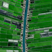
6. Remote Sensing: Remote sensing techniques, such as satellite imagery and aerial photography, are used to identify surface features associated with oil and gas reservoirs. These methods can detect anomalies like oil slicks, seepages, or vegetation patterns that may indicate the presence of hydrocarbons.
7. Data Integration and Modeling: Petroleum geologists integrate and analyze data from various sources, including geological, geophysical, and geochemical data, to build comprehensive models of subsurface structures. These models help identify potential oil and gas reservoirs and guide exploration efforts.
8. Drilling and Exploration Wells: Once potential reservoirs are identified, drilling and exploration wells are used to confirm the presence of oil and gas. Core samples, well logs, and production tests provide further information about the reservoir's characteristics, such as its thickness, permeability, and fluid content.
9. Reservoir Evaluation: Petroleum geologists use reservoir evaluation techniques to estimate the size, productivity, and recoverable reserves of oil and gas fields. This involves analyzing well data, reservoir pressure, fluid properties, and production history to assess the commercial viability of the discovered reserves.
By employing these methods and techniques, petroleum geologists can locate and evaluate potential oil and gas reserves, enabling the exploration and production of these valuable energy resources.
Source: Various AI tools
Mining
Geography
Professors
Georgics
Engineering
Books tagged engineering
Science
Maps
Anthropology
Books tagged anthropology
Searched in English.
